Topic: GOOGLE - on August 16, 2009 at 12:05:00 PM CEST
Integrating 50 centimeter data from the National Geospatial Intelligence Agency
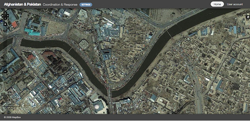
Today at the Camp Roberts exercise we integrated 50 centimeter data form the National Geospatial Intelligence Agency (NGA) into our mapping stack, which is acting as a "incident" visualization dashboard. In short, Robert and Tom have built a lightweight Drupal aggregation hub sucking in Pakistan and Afghanistan incident reports coming in from both Relief Web and IRIN. The incidents are being geo-tagged thanks to Alex's (who is back in the DC office) work on a lightweight geo-coding tool that we have been investing in with the support of the Knight Foundation.


